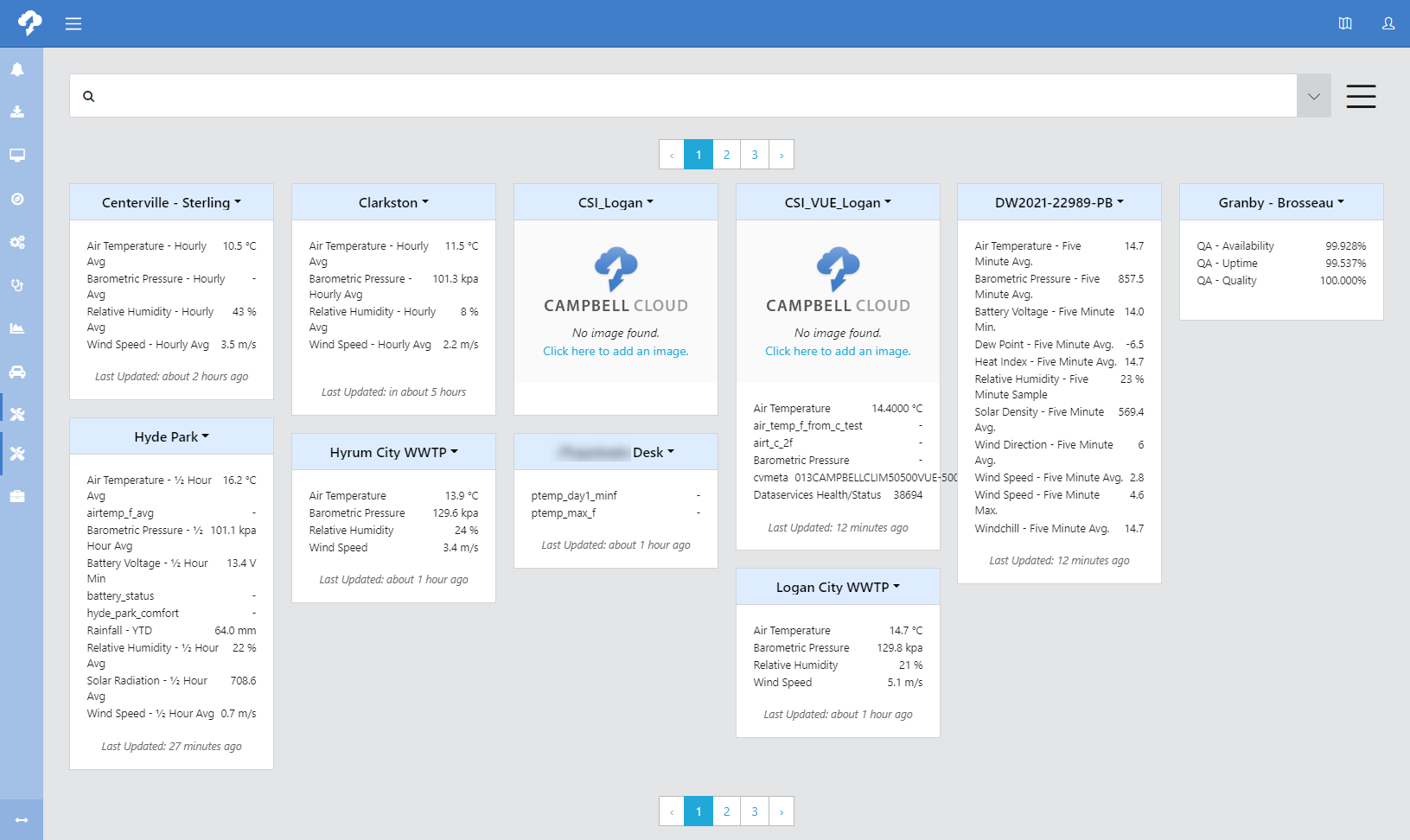
Tile view
Tile view displays a tile providing overview information for each station in the network.

The following options are available using the drop-down menu next to a station name. The first ten options will open a side pane on the right side. In addition to using the drop-down menu, you can navigate between these options with tabs at the top of the side pane. The remaining options navigate to other functions within CAMPBELL CLOUD.
When navigating between tabs on the side pane, always make sure to click  before navigating to a different tab. Otherwise, your changes will be lost.

This option allows you to view and update station information:
-
ID/SID (read only): Internal identification to ensure data is secured to this station.
-
Name: Configurable station name.
-
Date Installed: Date the station was first installed.
-
Labels: Labels that can be used for searching throughout CAMPBELL CLOUD.
This option allows you to add, view, and update ![]() data source A sensor measurement storage device used to ingest data into CAMPBELL CLOUD. A data source may be a data logger, smart sensor, internet data repository accessed by API or FTP access, camera, messaging device, or control equipment. It may also be a flat data file that is automatically or manually loaded into CAMPBELL CLOUD. information. See Adding a station.
data source A sensor measurement storage device used to ingest data into CAMPBELL CLOUD. A data source may be a data logger, smart sensor, internet data repository accessed by API or FTP access, camera, messaging device, or control equipment. It may also be a flat data file that is automatically or manually loaded into CAMPBELL CLOUD. information. See Adding a station.
Assets are parts of the station that are not data sources. This option allows you to track metadata for station assets.
Where the station is located. Edit the location by entering latitude/longitude or by dragging the map pin. Elevation will be generated based on latitude/longitude. Advanced allows you to input additional optional information such as address, access requirements, vegetation type, land use, roughness classification, slope, obstruction value, non-ambient signal sources, soil characteristics, and atmospheric pressure data level. Multiple locations can be entered for a station, but only one is active at a time.

Scroll through the pre-configured options to select the tile to display for the station. Click  to save your selection.
Favorite image is selected on Files tab ![]() .
.

Scroll through the pre-configured options such as snow accumulation, snow depth, and winter road hazard. The required measurement types for each insight are listed.

Select measurements to appear in the station tile. Type in Search box to narrow the list of measurements. Once all desired measurements are selected, click  to save your selections.
Use this tab to upload files associated with the station. For example, this can be used to upload an image of the station. Press + to add a file. Once a file has been uploaded, press the ellipsis next to the filename to Download or Delete the file. For an image file, this can be also be used to Set as Favorite Image for the station.

Use this tab to view and record diary entries for this station (for example, maintenance performed).

Use this tab to view the station Contacts and enable/disable them.
Opens the station in Network Health.
For CAMPBELL CLOUD users that have access to the older classic view screens, this option will take them there. It is not available for other users.
Opens the station in Measurements.